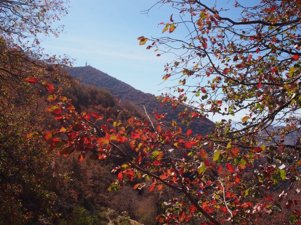
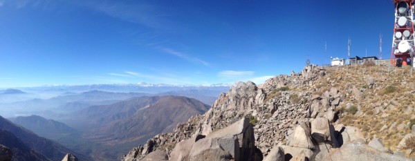
I took the day off yesterday to hike up to El Roble, not far from Til Til, home to prickly pear cacti and the fruit they bear (which we call tunas), olives, avocados and other things that enjoy the heat and sunshine. Unlike me. But we shall get to that later. First, see that tiny thing up at the top of the hill in the background? That is the Entel communications tower, and beside it (not visible in the picture) is the El Roble Observatory. That is our goal. Six kilometers, assures one of our party. I think it’s ten, says another. Who wins? (ten, according to some km-markers on the route).
If you are a long, long-time reader of this blog, or a stalker with an excellent memory (hi stalkers!) you may know that I went to this spot 5 years ago, on an ill-advised bike ride with a whole passel of very young men, all of them much better cyclists than me, and with bikes more appropriate to the terrain. It was painful. And freezing. But visually arresting, as Chile so often is.
Which is why it didn’t occur to me that it would be like 80 degrees and sunny yesterday on this uphill slog. No matter, with views like these (and a group of four master hikers keeping me motivated), it was well worth it.
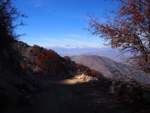
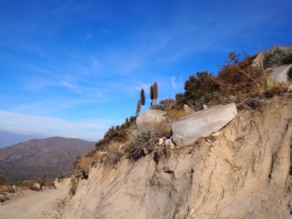
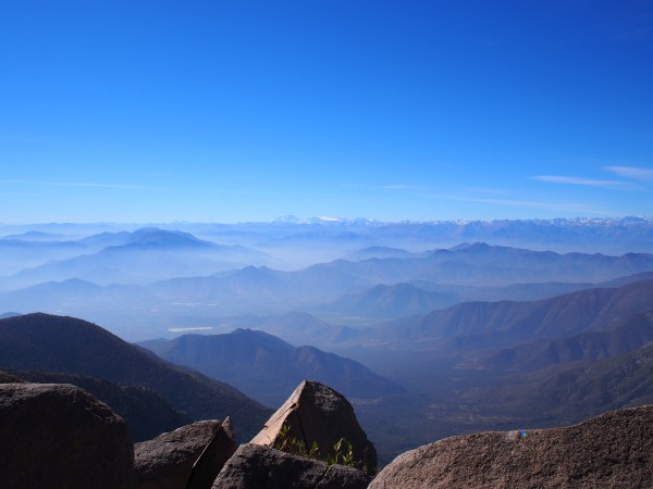
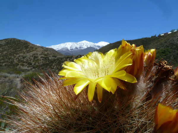
There is a trail, but we ended up hiking up the road (see above, and those plants are called chaguales, if you were wondering), with the idea that the view would be better. This may have been where the six-ten discrepancy came in. But view? Yes. However, what is missing from my life (from all of our lives?) is a peak-naming app. We figured out which one was Aconcagua (tallest mountain on the continent, perhaps not a very challenging test), one of our group named a couple of other peaks, and we listened to one of the guys from Entel tell us which ones (other side) were La Campana and Ocoa. He seemed to want to make conversation with us, though three-plus hours of uphill walking does not generally a great conversationalist make.
We saw many un-named (to us) peaks and features, such as an expansive glacier just to the right of Aconcagua, which we decided was not San Francisco, El Morado, or any of the other semi-close to Santiago glaciers, because it was not in the right spot. I wondered if it was in Chile or Argentina (Aconcagua is in Argentina), and remembered that a territorial dispute between Chile and Argentina were decided by the “high peaks” as opposed to “boundary waters” (wrong term, should have said “fluvial watershed”), method. I thought the decision was much older than it is. Turns out it’s just from 1902. If you want to read more, about the Cordillera of the Andes Boundary Case 1902, give a click right there.
And when we asked the guy from Entel what the large flat (clearly glacial) feature was, he said, “oh, that’s a glacier.” He needs the app, too, seems like, despite his oriundo (person from the place you are, kind of like the word “local” in English) knowledge . He was, however, able to tell us the name of the tame fox that hangs around the communications tower, because they give him “pancitos,” which could mean bread, or little sandwiches, but I’m guessing he means bread.
His name is Claudio. The fox, not the guy.
There are no photos of Claudio, nor the other two foxes we saw on the way up, which I believe were zorro culpeo, but I could be wrong. We also saw and heard a lot of birdlife, but the only one I really got a fix on was a dove-like bird commonly called a “torca” or “torquita” or “turquita”, which has a patch of white on its neck/chest, and fan-like tail that sticks up at the back. It made a trilly sound, half pigeon, half quail. It’s in the dove family, not surprisingly. And we saw a lone aguilucho, which is of the hawk family, but it’s not clear to me what species it was. They’re common enough, and if you’ve never seen a condor (whose wingspan, or envergadura (one of my favorite words in Spanish) is 10 feet), you might confuse one of these small birds of prey (wingspan about 3 feet) for one.
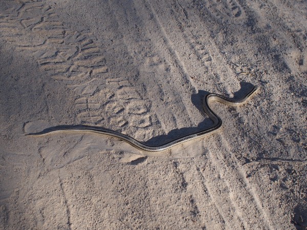
Oh! and a snake! Saw one of those as well.
This is only the second time I’ve seen a snake in Chile, and it was moving slowly, like it didn’t want us to notice. I thought it was non-venomous, but it turns out to be only semi-venomous. Do you only half-die if it bites you? Must investigate. We still gave it its space, nobody likes to be hovered over. Oh, and the name of this snake? Long-tailed snake (culebra de cola larga). I hate to dither over taxonomy, but how do you decide which snake has a long tail and which doesn’t? It kind of seems like snakes are mainly comprised of head and tail. But if I have demonstrated nothing in this blog post, it is that I am not a wildlife biologist.
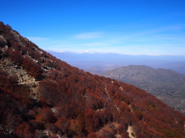
But look: pretty.
I also learned that there are two kinds of muscle contractions involved in hiking, one of which, the one which you use to set something down gently, or to brake yourself from flying down the mountain and onto your face is called eccentric, and it is this kind of contraction that is excellent at producing the microtears that build muscles. So if you see me, please tell me what large tibialis anteriors I have. Because they are kvetchy today.
And that, my friends is how two almond-butter (and salt) sandwiches, some grapes, four friends and not quite enough water led to me sleeping a solid ten hours last night. Difficulty: “easy.”

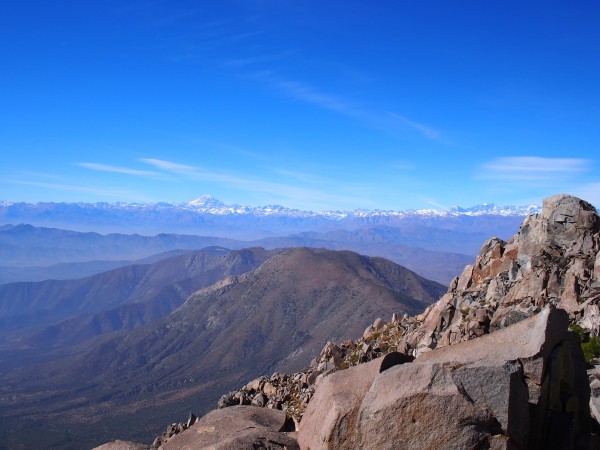



My brother and brother-in-law have climbed Aconcagua and would possibly be able to name its neighbor peaks but I’m a mountain novice so to me they all just look impossibly big. Thanks for taking beautiful pictures so I can see without the twitchy leg muscles.
oh, cool! I just want a lucite sheet with the peaks marked on it. Chileans are always like “you see that one, then that other one, then that other other one that is kind of beside it but not next to it?” And I’m all: no. 🙂 muscles seem mostly all better now, what’s weird is what a toll it took on my calves and not my thighs. Wonder why!
I do enjoy the hills. I am not surprised you slept so well, I looked it up, 2,200m height, that is a fair climb for a single day for sure.
After reading that Cerro El Plomo was the largest peak visible from Santiago, I assumed it would be some distant thing that you’d have to know where to look for a dot on the far horizon on the 3 days of the year with perfect visibility. But the other day I was in Las Condes and I thought “oh, that must be it”. Very big and obvious, actually. I googled imaged search later, and yes it was it. After that I then noticed in the next few days that it was visible from all over Santiago, and in fact that I had seen it many times before without realising what a high peak it was, then I could even see it very clearly from out here in Talagante, out in the countryside to the South West of the mountain, 50 miles and through Santiago’s smog.
I note that from where you took your photos of Aconcagua (from bang on 100km away, or 62 miles) you were no closer to the mountain, as the crow flies, than you would be in Las Condes. And yet you don’t see the big one from the city. That’s not because of smog, though. I got curious and displayed contour lines on google maps. I see that Santiago is at an altitude of around 400m-800m, Aconcagua I know is around 6,900m, and the contour lines shows, to the left of Cerro El Plomo, peaks and terrain at 3,000-4,000m altitude only about 1/3 of the way from Santiago to Aconcagua to Santiago, and directly in between. From the look of google maps there is no part of the city that would ever have a line of sight to Aconcagua as far as I can see.
hey, thanks for dropping in. And yes, we cannot ever see Aconcagua from the city, as far as I am aware. You’ve got to swing wide, so Plomo doesn’t get in the way (I guess). And yes, it was about a 1,000 meter gain from start to the top. I’m also just a good sleeper, so there’s that. Are you in Talagante? You certainly do get much better air quality than we do in Santiago. I’ve probably ridden my bike past your house a number of times! No mountains out today, sadly! Just mist.
I live on the road between Talagante and Isla de Maipo. Visibility comes and goes there is a lot of mist in the mornings.
Look forward to your next post.
Stunningly gorgeous photos, Eileen! Thanks for taking us with you on your hike.
why thank you, Sally! It’s a lovely place. What’s funny is that I passed by there just yesterday headed someplace else and it was near white-out conditions with the mist. What a difference two days make!